


C-MAP Boating

C-MAP Boating açıklaması
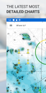
C-MAP® Uygulaması eğlence amaçlı tekneciler ve su severler için mükemmel bir arkadaştır. Mobil, Tablet veya PC'de mevcut olan, dünyanın neresinde olursanız olun, her zaman en güncel C-MAP grafiklerine erişebileceksiniz.
Nerede olursanız olun İlgi Çekici Noktaları ve Rotaları keşfetmenize, planlamanıza ve kaydetmenize olanak tanıyan tüm özelliklere sahip olan C-MAP Uygulaması, bilgili tekneciler için mükemmel bir navigasyon yardımcısıdır.
C-MAP Uygulaması şunları içerir:
- ÜCRETSİZ Grafik Görüntüleyici
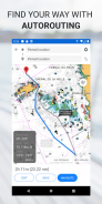
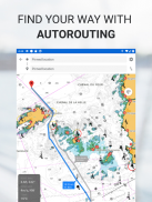
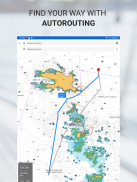
- Autorouting™ – en sevdiğiniz yerlere giden en iyi rotayı bulun
- Kişisel Yol Noktaları
- Parça Kaydı
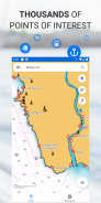
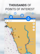
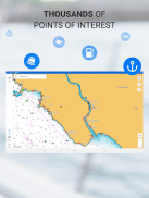
- Binlerce önceden yüklenmiş İlgi Çekici Nokta
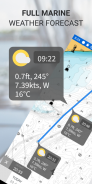
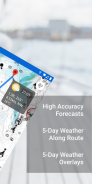
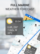
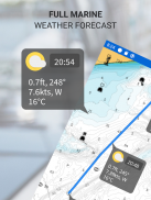
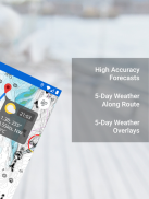
- Deniz Hava Durumu Tahmini
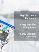
- Rota Boyunca Hava Durumu
- Hava Durumu Katmanı
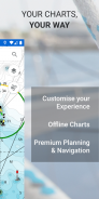
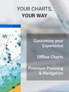
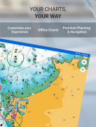
- Grafik Kişiselleştirme
- GPX Dosyalarını İçe ve Dışa Aktarın – Rotalarınızı, Parkurlarınızı veya Yol Noktalarınızı arkadaşlarınızla paylaşın
- Mesafe Ölçme Aracı
Aşağıdakiler gibi ek özelliklerin kilidini açmak için Premium'a yükseltin:
- Tam GPS İşlevselliği
- Çevrimdışı Harita İndirmeleri
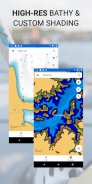
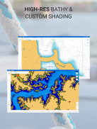
- REVEAL Gölgeli Rölyef
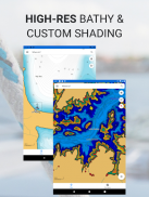
- Yüksek Çözünürlüklü Batimetri
- Özel Derinlik Gölgeleme
- AIS ve C-MAP Trafiği
Satın almadan önce deneyin… 14 günlük ücretsiz deneme süresiyle C-MAP App Premium'u kendiniz deneyimleyin.
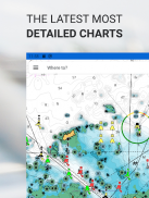
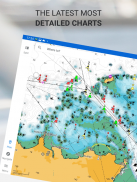
C-MAP Uygulaması sürekli olarak güncellenerek en yeni, en güncel haritaların her zaman parmaklarınızın ucunda olmasını sağlar.
Gizlilik Politikası:
https://appchart.c-map.com/privacy.html
Kullanım Şartları
https://appchart.c-map.com/tos.html
C-MAP Boating - Sürüm 4.5.2
(10-04-2025)
C-MAP Boating - APK Bilgisi
APK sürümü: 4.5.2Paket: com.isea.EmbarkC-MAP Boating uygulamasının en son sürümü
Diğer sürümler


 4.71
4.71


Aynı kategorideki uygulamalar

Hoşuna gidebilecekler...


